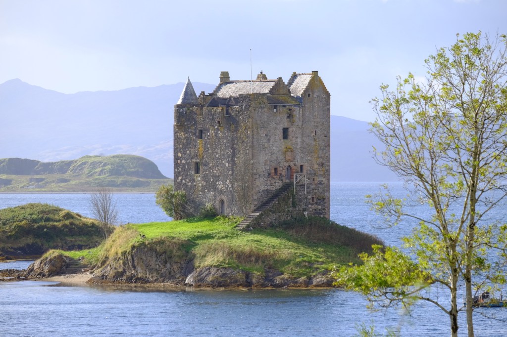
Day Three – Rain, Rituals and Five Thousand Years of Secrets
Kitchen in the Wild: The Long Way to Eilean Shona
A Rather Damp Start to Five Thousand Years of History
Wednesday morning, 6:30am.
I was wide awake, excited and ready to go. After months spent researching Scotland’s ancient past, and finally arriving in Kilmartin the previous evening, today was the day I’d been particularly looking forward to, first things first, however. A cup of tea.
Pulling back the curtains revealed that Scotland had thoughtfully arranged some traditional weather for the occasion.
It was absolutely pissing down!
Not a gentle Highland mist, nor the occasional romantic shower drifting across the glen. Proper, persistent rain. The sort that makes you question the wisdom of leaving a perfectly comfortable bed, particularly when your day’s itinerary involves wandering around wet fields looking at large rocks.
Still, I’d travelled several hundred miles, produced a professionally printed guide of more than 55 pages and spent countless evenings investigating ancient burial practices, mysterious standing stones, prehistoric migrations and the origins of early Scottish civilisation, I wasn’t about to be defeated by a bit of water.
Tea consumed, camera equipment gathered and waterproofs brought into service, it was time to go hunting stones.
Kilmartin Glen – Where Five Thousand Years of History Lie Beneath Your Feet
There is something quite extraordinary about Kilmartin Glen.
At first glance, it’s a beautiful stretch of Argyll countryside: rolling green fields, woodland, low hills and the occasional scattered farmhouse. But look a little closer and the landscape begins to reveal something altogether more remarkable.
Within a relatively small area lie hundreds of archaeological sites, including burial cairns, standing stones, stone circles, fortified settlements and mysterious rock carvings. Some date back more than 5,000 years. To put that into perspective, people were constructing ceremonial and burial monuments here during the Neolithic period, long before the Roman Empire existed and centuries before the great pyramids of Egypt were built.
And unlike an archaeological collection housed neatly behind glass in a museum, much of Kilmartin’s extraordinary history remains out in the landscape, where successive generations left their mark. You can walk between monuments, study enormous stones and, in some cases, peer into burial chambers constructed by communities whose names, languages and beliefs have long since disappeared.
The remarkable thing is that nobody left an instruction manual.
Archaeologists can learn a great deal from their tools, pottery, burial practices and surviving monuments, but precisely what many of their ceremonies meant, why particular locations were chosen and what significance they attached to certain arrangements of stones remains tantalisingly uncertain.
Which, naturally, makes the whole business considerably more intriguing.
Who Were These People, and Where Did They Come From?
One question had particularly occupied me during my pre-trip research.
Who exactly were the people responsible for constructing these extraordinary monuments?
Were they descendants of Scotland’s earliest hunter-gatherers? Had they arrived from elsewhere? And how did communities living in what we now regard as a relatively remote corner of Scotland come to share ideas, materials and artistic traditions with people living hundreds, sometimes thousands, of miles away?
Modern archaeology, particularly the extraordinary advances made through ancient DNA analysis, has begun to reveal a much more complicated picture.
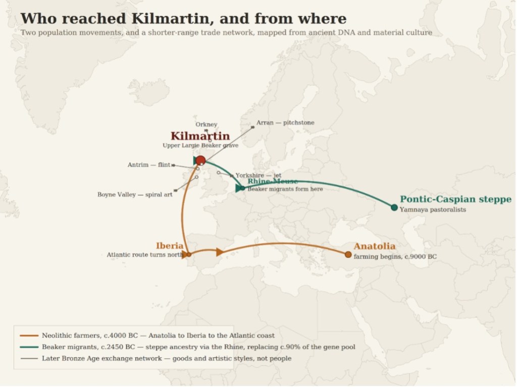
The first great transformation came around 4000 BC, with the arrival of Neolithic farming communities in Britain.
Their deeper ancestry can be traced to early farming populations originating in Anatolia, part of modern-day Turkey, from where agriculture gradually spread across Europe. One important route followed the Mediterranean and Atlantic seaboard through Iberia and western Europe before eventually reaching Britain.
These newcomers brought a fundamentally different way of life. Farming, domesticated animals, pottery and the construction of substantial ceremonial and burial monuments increasingly became part of a landscape previously occupied by communities dependent primarily upon hunting, fishing and gathering.
They also brought different ways of honouring their dead, some of which survive in the great stone monuments we’re still attempting to understand today, but that wasn’t the end of the story.
Around 2450 BC, Britain began experiencing another major population transformation associated with the arrival of people belonging to the Bell Beaker cultural phenomenon. These migrants had strong genetic connections with populations in north-western continental Europe, particularly around the Lower Rhine, and carried substantial ancestry ultimately derived from pastoralist populations of the Pontic-Caspian steppe.
And here’s where things become particularly interesting.
Ancient DNA research indicates that, over the centuries following their arrival, approximately 90% of Britain’s earlier Neolithic genetic ancestry was replaced. That’s an extraordinary demographic change. It doesn’t mean 90% of Kilmartin’s inhabitants suddenly vanished, but it does demonstrate just how profoundly migration altered the population of prehistoric Britain over successive generations.
The Beaker period also saw changing burial customs, including a greater emphasis on individual burials accompanied by carefully selected possessions, alongside developments in pottery, metalworking and wider material culture.
Suddenly, the landscape of Kilmartin begins to make considerably more sense, its monuments weren’t all constructed at once, nor necessarily by people sharing identical customs, ancestry or beliefs. The glen developed over many centuries, reflecting successive generations and changing ideas about life, death and remembrance.
And it wasn’t only people who travelled.
Prehistoric communities were connected through surprisingly extensive networks of exchange. Materials such as Arran pitchstone, Irish flint and Yorkshire jet moved considerable distances, while artistic ideas and symbolic traditions also spread between communities.
The remarkable spiral carvings associated with Ireland’s Boyne Valley, for example, form part of a much wider Atlantic prehistoric artistic tradition. Such connections don’t necessarily prove that the same people travelled between every location, but they demonstrate that these communities were far from isolated. The map brings these different strands together: two major population movements separated by around 1,500 years, followed by wider networks through which materials, skills and ideas circulated.
I found this particularly fascinating.
Here was a landscape that successive communities, living thousands of years apart, continued to recognise as somewhere important enough to bury their dead, construct monuments and leave their mark upon the stone.
What made this particular glen so significant?
That’s the question I’d come to explore.
And here I was, several thousand years later, standing in the Scottish rain with a camera, a printed guide and the considerable advantage of a hire car, at least I didn’t have to walk here from Anatolia!
Dunchraigaig Cairn – The Deer Beneath the Stone
One of the places I’d been particularly keen to explore was Dunchraigaig Cairn, a prehistoric burial monument that has yielded one of Scotland’s most remarkable archaeological discoveries.
And from a distance, it doesn’t exactly announce itself.
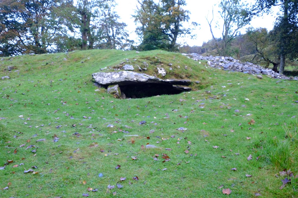
A low, grass-covered mound, scattered stones and a small opening beneath an enormous slab of rock. Without knowing its history, you might easily pass it by, yet concealed beneath that great capstone is something extraordinary.
In 2021, prehistoric animal carvings were identified on the underside of the capstone. Five figures, including two magnificent adult red deer stags, thought to date from the Early Bronze Age, around 4,000 years ago.
These are the earliest known prehistoric animal carvings discovered in Scotland.
What makes the find particularly unusual is that prehistoric Scottish rock art is overwhelmingly abstract. Cup marks, concentric rings and geometric arrangements are relatively familiar features of the landscape, but recognisable representations of animals are exceptionally rare.
Here, hidden beneath a burial monument, someone had taken the trouble to depict creatures that must have held some significance in their world.
And I was determined to see them.
This proved considerably more challenging than anticipated, especially with the considerable downpour and position of the markings meaning some body dexterity was required beyond normal human capability.
The entrance isn’t exactly designed with the comfort of modern visitors in mind, and photographing the underside of an enormous prehistoric stone while negotiating a confined space, damp rocks and a rather awkward camera angle requires a degree of physical improvisation.
Not to mention the fact that the carvings themselves are extraordinarily difficult to distinguish.
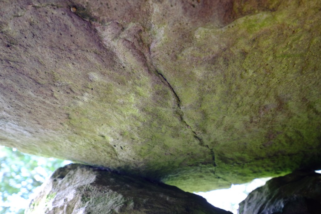
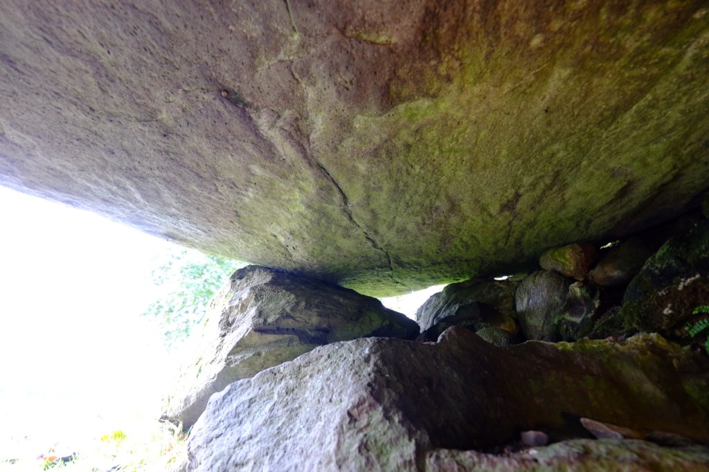
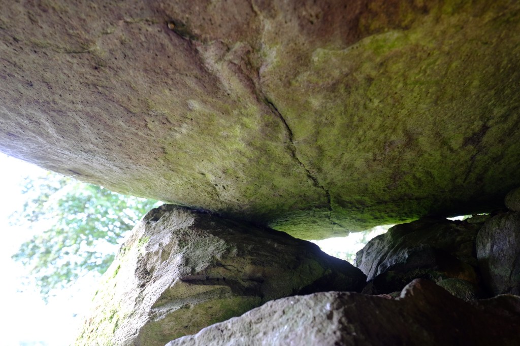
The figures were created by painstakingly pecking and working the stone’s surface. Thousands of years of weathering, however, have left their outlines so faint that ordinary photography struggles to reveal them.
Researchers subsequently used high-resolution 3D scanning and digital surface-enhancement techniques to identify and document the individual animals.
The most remarkable is a large red deer stag, affectionately nicknamed the Fabulous Stag, whose sweeping antlers and anatomical details reveal a surprisingly accomplished understanding of the animal.
Interestingly, the carvings are positioned so that the larger stags appear upside down when viewed from inside the burial chamber today. The precise circumstances in which they were created, and whether the stone was decorated before being incorporated into the monument, remain subjects of archaeological interpretation.
The discovery raises some fascinating questions.
Were these animals associated with hunting, social status, spiritual beliefs or something altogether different? Did they hold a particular significance for the people buried here?
We simply don’t know.
But imagine someone thousands of years ago, carefully working the image of a deer into this enormous slab of rock. Not a casual afternoon’s doodling, but a deliberate act requiring considerable time, skill and effort.
And here I was, around four millennia later, attempting to photograph the result with a digital camera while trying not to become permanently wedged beneath the monument.
Progress, of sorts.

My own photographs didn’t reveal the carvings quite as successfully as I’d hoped, so I’ve included a published archaeological reference image to illustrate what is actually concealed within the stone.
Comparing the two gives some idea of just how remarkable the discovery is. Without the benefit of specialist lighting and modern archaeological imaging, these ancient animals might easily have remained unnoticed.
Standing beside what initially appears to be little more than a collection of weathered rocks in a Scottish field, it’s extraordinary to think that someone left these images here thousands of years ago.
And that, perhaps, is what makes Kilmartin so captivating, the more closely you look, the more the landscape begins to reveal.
And I’d barely started hunting stones.
Nether Largie – Standing in the Company of Giants
My next encounter with Kilmartin’s prehistoric inhabitants was only a short distance away, at the Nether Largie Standing Stones.
By now, the Scottish weather had begun to show a little mercy. The rain was easing, although the ground remained thoroughly saturated, and the surrounding fields had acquired that almost impossibly vivid shade of green that Scotland seems able to produce without the assistance of Photoshop.
And there, rising out of the grass, stood six enormous stones.
Four form an arrangement rather like a rough X, with another two standing slightly apart. Weathered, irregular and covered in extraordinary patches of moss and lichen, they command attention despite the apparent simplicity of their construction.
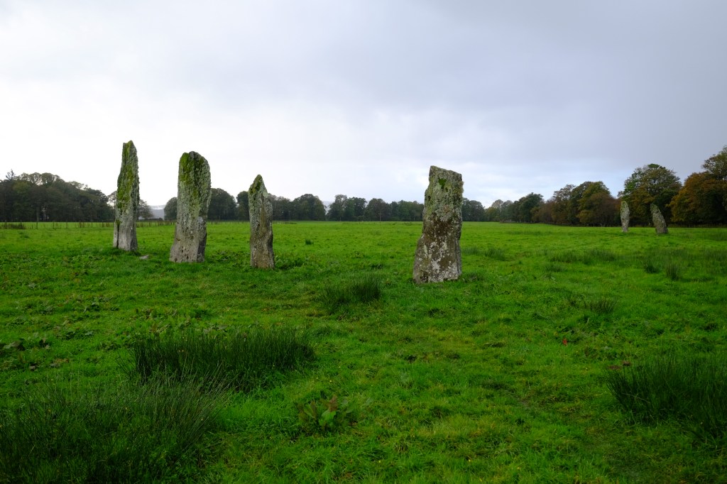
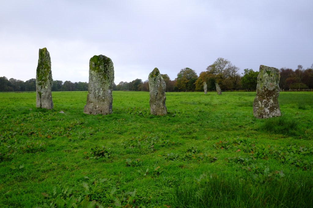
Thought to have been erected during the Middle Bronze Age, roughly 3,000 years ago, these monuments belong to a later chapter of Kilmartin’s prehistoric story than some of the great Neolithic ceremonial sites nearby.
Their precise purpose remains uncertain.
Were they territorial markers, gathering places or monuments associated with religious and ceremonial activities? Various astronomical alignments have also been proposed, although interpreting prehistoric intentions from arrangements of stone requires a certain amount of caution.
Whatever their purpose, somebody went to considerable trouble to select, transport and erect these massive slabs, long before the invention of anything resembling a convenient hydraulic lifting device.
And they weren’t simply left standing without further attention.
Ancient Marks – Leaving Something for Posterity
Moving closer to one of the larger stones, I became fascinated by its surface.
What appeared from a distance to be little more than weathered rock revealed a wonderfully complicated landscape of its own. Great colonies of pale grey lichen spread across the stone, contrasting with brilliant green moss clinging to its upper edges and crevices.
And then there were the small hollows.
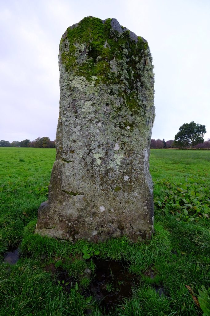
Some of the Nether Largie stones bear prehistoric carvings known as cup marks, occasionally accompanied by concentric rings. These were created by repeatedly striking or pecking the rock with a harder stone, gradually forming shallow depressions in its surface.
Simple enough in appearance, but their significance is anything but straightforward.
Similar carvings appear throughout prehistoric Britain and Ireland, particularly in landscapes associated with Neolithic and Bronze Age activity. Some are found on exposed rock surfaces, others on standing stones and burial monuments.
Were they symbolic representations of celestial bodies, markers of significant places, expressions of spiritual beliefs, or something entirely different?
Nobody knows for certain.
Not every hollow in an ancient stone is necessarily prehistoric artwork, of course. Natural weathering can produce remarkably convincing imitations. But the confirmed carvings at Nether Largie add another intriguing layer to an already extraordinary monument.
What particularly appealed to me was the contrast between the immense age of the stone and the delicate living organisms now covering its surface.
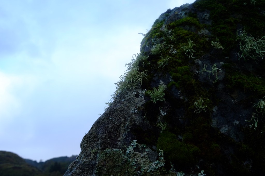
Thousands of years of human history, slowly being reclaimed by nature.
And considerably more successful than anything I’ve ever attempted to grow in the garden.
Looking out across the surrounding countryside, the setting itself was magnificent. Great green fields stretched towards distant hills, their upper slopes partially concealed beneath a low blanket of cloud.
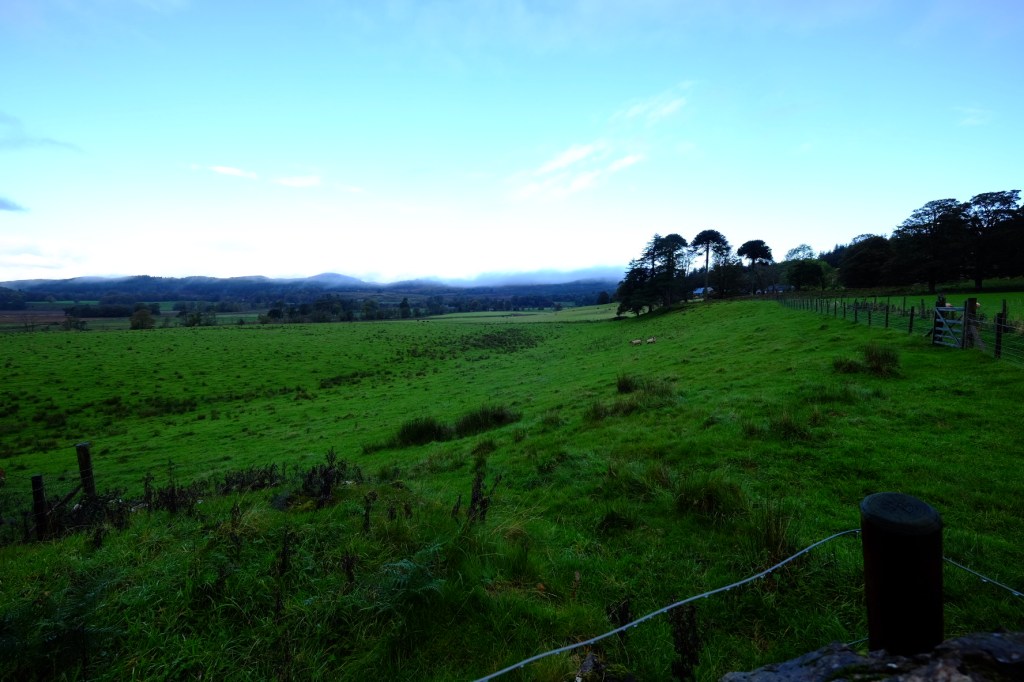
It was easy to understand why people might have considered this landscape special, even if the exact reasons behind their extraordinary monuments remain beyond our reach.
There was, however, something else nearby that I’d been particularly keen to explore.
And this one involved considerably more stones.
Temple Wood – A Circle of Life, Death and Mystery
A short distance from Nether Largie lies Temple Wood, one of the most fascinating prehistoric monuments in the glen.
At first sight, it appears to be a great circular arrangement of weathered stones emerging from a broad bed of rounded cobbles, with mature trees and beautiful countryside providing a wonderfully atmospheric backdrop.
But the site is considerably more complicated than it initially appears.
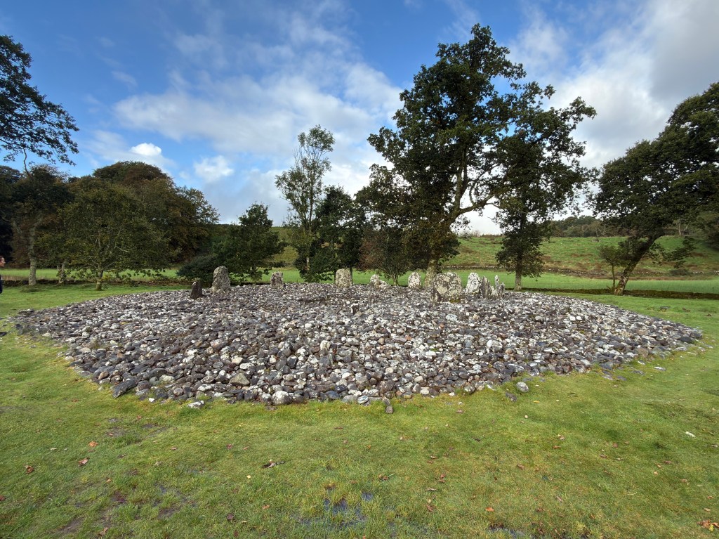
Temple Wood contains the remains of two prehistoric circles, commonly referred to as the northern and southern circles, whose development stretches across approximately two thousand years.
The earliest known activity began around 3500–3000 BC, when a circle of timber posts was constructed at the northern site. This was subsequently replaced, or at least partly replaced, by stone. Around 3000 BC, a larger oval arrangement of approximately 22 upright stones was established to the south-west.
What makes Temple Wood particularly interesting is that its purpose appears to have changed over time.
Initially associated with ceremonial activity, the southern circle was gradually modified. Low slabs were inserted between the standing stones, restricting physical access while still allowing people to see inside. Later, during the Bronze Age, burial cists were incorporated into and around the monument, and much of the circle was eventually filled with a great accumulation of stones.
In other words, what we see today isn’t simply an ancient stone circle.
It’s the surviving result of generations of activity, alteration and remembrance, with each successive community leaving something of its own behind.
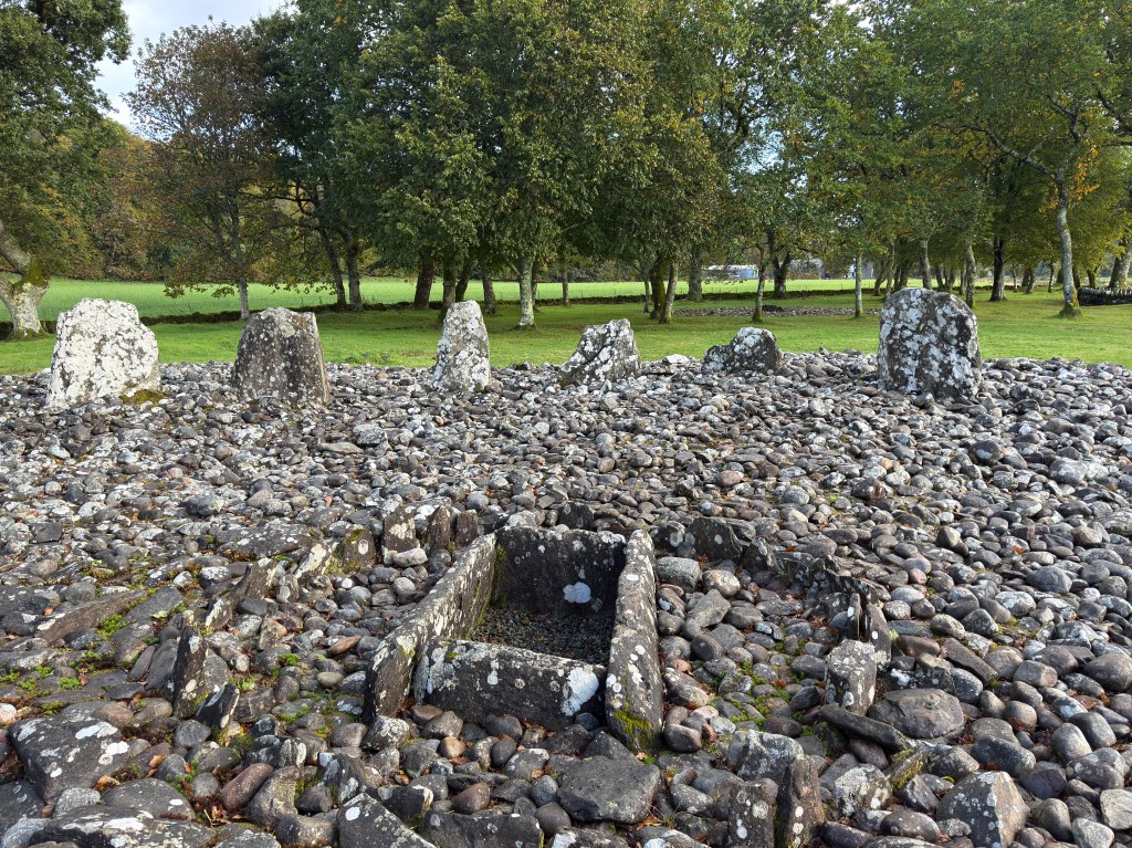
The exposed cist is particularly fascinating.
Essentially a small stone-built coffin, it provides a tangible connection with the funerary purpose the site eventually acquired. Excavations at Temple Wood revealed burial-related objects including pottery, flint arrowheads and mineral pigments such as red and yellow ochre.
Remarkably, the only surviving human remain recovered from within the southern circle was a child’s tooth.
A very small fragment of an individual life, preserved within an enormous monument constructed and modified over centuries.
There’s something rather moving about that.
Temple Wood also contains some extraordinary prehistoric artwork. One of its standing stones bears a carved spiral motif reminiscent of designs found in Irish passage-grave art, providing another intriguing connection with those wider Atlantic traditions discussed earlier.
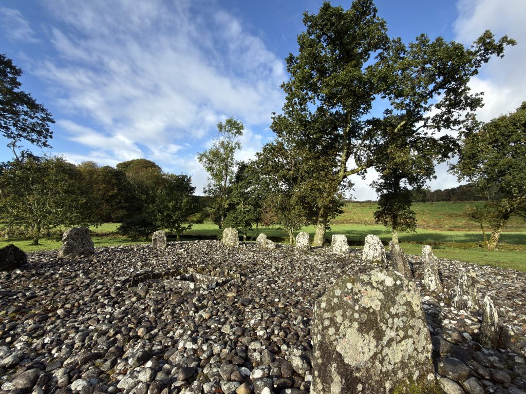
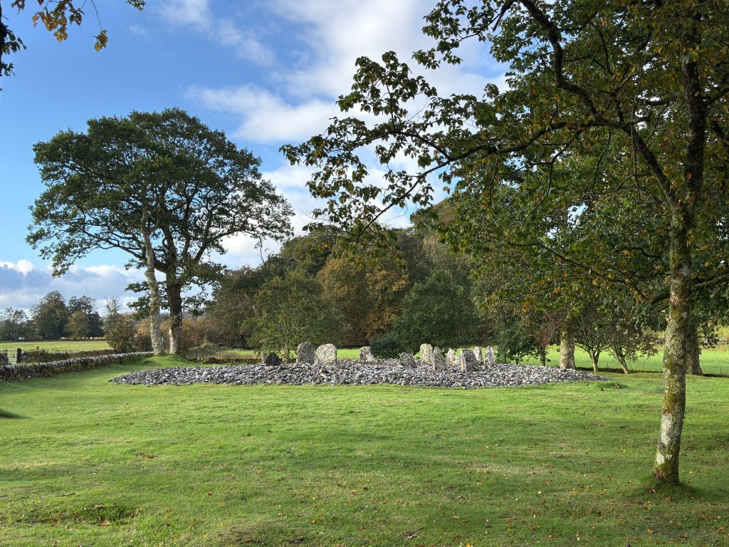
By now, the weather had undergone something of a transformation. The rain had given way to patches of blue sky, and sunlight was beginning to break through the clouds, illuminating the stones and surrounding trees. The change in atmosphere was wonderful. Here was a place that had witnessed thousands of years of human activity, whose builders had disappeared into prehistory, yet whose monument continued to command attention.
What ceremonies took place here? What did these stones represent to the people who first erected them? And why did successive generations continue to return?
We may never know all the answers.
But I suspect the people responsible would have been quietly pleased to discover that, five thousand years later, someone was still wandering around their creation, taking photographs and wondering what on earth they had been up to. My morning amongst the stones had been everything I’d hoped for.
It was, however, approaching the time when archaeology needed to make way for another important human tradition.
Lunch.
Oban – A Return to Civilisation, With Seafood
Leaving Kilmartin behind, I continued north towards Oban.
After a morning spent amongst burial chambers, standing stones and the remnants of prehistoric ceremonies, arriving in this bustling little harbour town felt like stepping forward several thousand years in one rather enjoyable journey. Often described as the Gateway to the Isles, Oban occupies a magnificent position on Scotland’s west coast, its sheltered bay providing an important departure point for ferries serving the Hebridean islands.
And there, crossing the water against a backdrop of distant hills and enormous billowing clouds, was one of Caledonian MacBrayne’s unmistakable ferries.
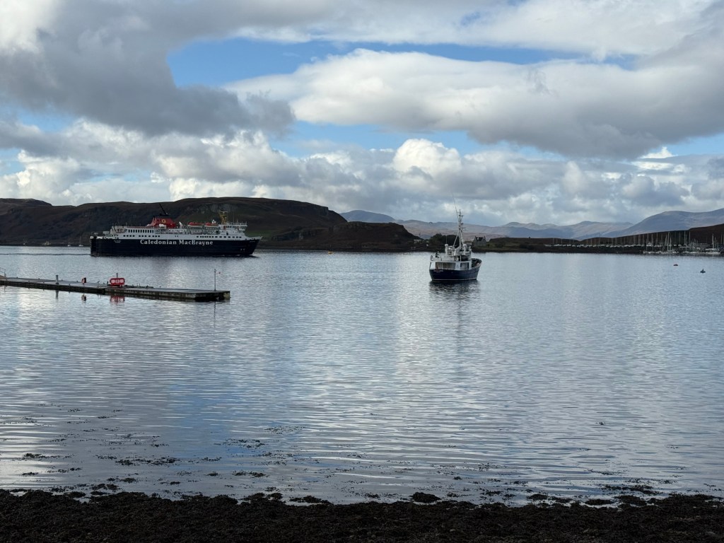
The harbour was a delightful mixture of working boats, pleasure craft and island ferries, with the surrounding hills providing a wonderfully dramatic setting. I spent some time wandering along the waterfront, taking in the atmosphere and enjoying the fact that, for once, the weather appeared to be cooperating.
Oban has long been associated with fishing, maritime trade and tourism, and there’s something particularly appealing about a town where the sea remains such an obvious part of everyday life. It also seemed an entirely appropriate place to investigate the local seafood.
Having devoted the morning to studying prehistoric burial practices, I thought a change of subject might be beneficial.
Ee-Usk – A Rather Welcome Lunch
After a morning spent exploring the resting places of Scotland’s prehistoric inhabitants, I decided it was time to concentrate on something considerably more appetising.
Lunch was at Ee-Usk, a seafood restaurant overlooking Oban’s bustling harbour. With the waters of the bay, fishing boats and ferries providing the backdrop, it seemed an entirely appropriate setting to sample some of Scotland’s wonderful seafood.
My choice was the oven-baked halibut, accompanied by creamed leeks and potato gratin.
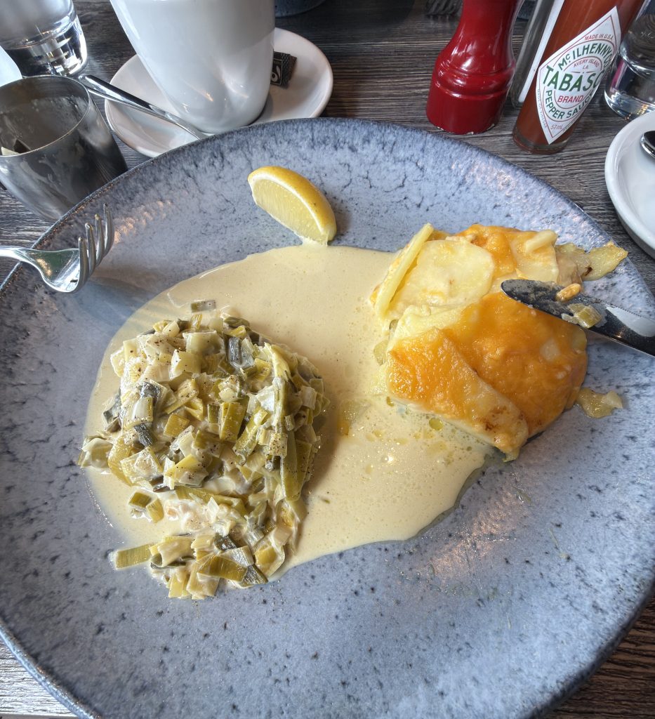
What arrived was a gloriously comforting plate of food. A generous fillet of halibut, its delicate white flesh beautifully cooked, accompanied by a substantial potato gratin with a golden, bubbling cheese topping. Alongside sat a generous helping of finely sliced leeks, softened in cream, with a rich, buttery sauce bringing everything together.
Halibut is a particularly lovely fish. Its firm, almost meaty texture allows it to retain its structure during cooking, yet when treated properly, the flesh separates into wonderfully moist, delicate flakes. Its flavour is mild and subtly sweet, making it an excellent partner for the richness of the accompanying cream.
The leeks provided their gentle onion sweetness, while the gratin contributed a welcome contrast of textures: a lightly golden surface giving way to soft layers of potato beneath. A squeeze of lemon cut through the richness beautifully.
This wasn’t food designed to challenge your understanding of modern gastronomy or leave you searching the plate for the principal ingredient. It was excellent produce, sympathetically cooked, generously served and thoroughly satisfying.
Exactly what I needed.
After spending the morning investigating how prehistoric communities honoured their dead, I was now paying considerably more attention to how the living should be fed.
And Ee-Usk had provided a rather compelling answer.
Oban – Whisky, Architecture and a Little Victorian Ambition
Suitably restored, I continued my wander around the town.
One of Oban’s most recognisable landmarks is its historic distillery, sitting remarkably close to the centre of town, with its distinctive chimney rising above the surrounding buildings.
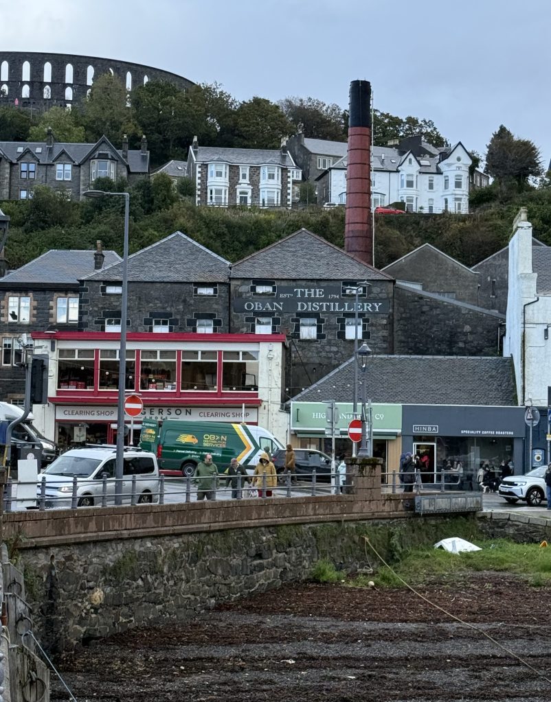
Established in 1794, Oban Distillery predates much of the modern town that subsequently developed around it.
It’s rather unusual to find a working malt whisky distillery occupying such a central position in a bustling coastal settlement, but the arrangement provides a wonderful reminder of the town’s commercial past. High above the distillery stands another of Oban’s most distinctive features: McCaig’s Tower.
Looking rather like somebody started constructing a Roman Colosseum on top of a Scottish hillside before deciding that the budget had become a little ambitious, the enormous circular structure was commissioned by local banker John Stuart McCaig during the 1890s.
His intention was partly to provide employment for local stonemasons during the quieter winter months, while also creating an enduring monument to his family. The original plans were rather grander than the structure that survives today, incorporating additional towers, galleries and commemorative statues.
McCaig died in 1902, and the ambitious project was never completed.
Nevertheless, what remains is one of Scotland’s more extraordinary Victorian follies, and undoubtedly gives Oban a skyline unlike almost anywhere else. An unfinished monument to personal ambition overlooking a town that had already given me an excellent lunch.
I rather liked the place, but it was time to continue north, as there was another historic structure waiting along the coast, and this one was perched on an island.
Castle Stalker – A Fortress, a Feud and a Rather Familiar Film Location
Continuing north from Oban along the coast towards Appin, the landscape became increasingly spectacular. The road passed between wooded slopes, tidal inlets and magnificent stretches of water, with distant mountains rising beyond the shoreline. And then, across the waters of Loch Laich, appeared one of the most photogenic castles in Scotland.
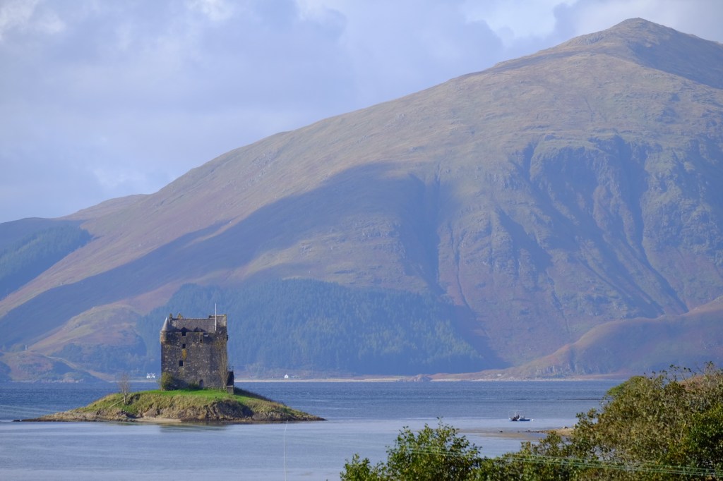
Castle Stalker stands on a tiny tidal island, its imposing stone tower rising above the water against a backdrop of forested hills and Highland mountains.
It’s one of those views that looks almost too perfectly Scottish to be real.
A medieval tower house, a small island, spectacular scenery and, on this particular afternoon, just enough changing sunlight to make the whole arrangement look as though somebody had organised the weather specifically for my camera. The castle’s origins are associated with the MacDougalls, who are believed to have established a small fortified structure here during the early fourteenth century.
The lands later passed to the Stewarts of Appin, and the present tower house is generally associated with Sir John Stewart of Lorn during the fifteenth century. Like so many Highland strongholds, its history is full of shifting loyalties, family rivalries, political intrigue and the occasional unfortunate disagreement settled with considerably more than a strongly worded letter.
One particularly dramatic episode concerns Sir John Stewart himself, who was fatally wounded outside Dunstaffnage Castle in 1463 by an adversary associated with the MacDougalls. According to the traditional account, he survived long enough to marry the mother of his son, thereby legitimising the child who would become the first chief of the Stewarts of Appin.
A wedding day that could hardly be described as going entirely according to plan.
Castle Stalker subsequently passed between the Stewarts and Campbells before eventually falling into disrepair. Thankfully, twentieth-century restoration secured its survival, leaving us with the wonderfully atmospheric building visible today. And if the castle looks vaguely familiar, there’s another reason. It appeared in the closing sequence of the 1975 film Monty Python and the Holy Grail, portraying the gloriously named “Castle Aaargh”.
A building with centuries of clan warfare, murder and political intrigue behind it, ultimately achieving additional fame thanks to a group of comedians searching for the Holy Grail.
History does occasionally have a rather wonderful sense of humour.
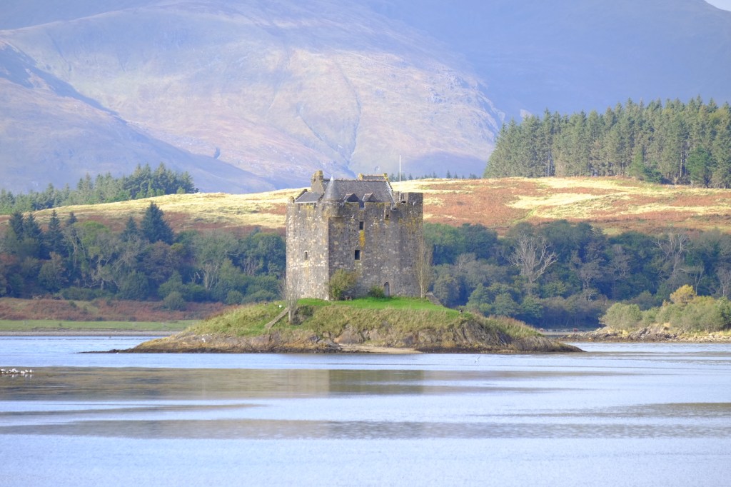
I spent a little time photographing the castle from the mainland, trying different compositions as the light shifted across the water and surrounding hills. The closer view reveals just how substantial the tower is, while the wider photograph captures what makes its setting so extraordinary. It was another of those places where the photograph almost takes itself.
Almost.
By now, I’d travelled from prehistoric burial monuments to a bustling harbour town and onwards to one of Scotland’s most evocative medieval castles, all in the space of a few hours.
And the day’s journey was far from over.
The road north was calling, and somewhere ahead lay the extraordinary landscapes of the western Highlands. Five thousand years of prehistory in the morning, fifteenth-century clan warfare in the afternoon.
Not bad for a Wednesday.
The Corran Ferry – Five Minutes to Another World
Leaving Castle Stalker behind, I continued north along the shores of Loch Linnhe towards the Corran Ferry. By now, the afternoon was moving on, and although I’d packed an extraordinary amount into the day, there was still some distance to cover before reaching my overnight accommodation in Acharacle.
The Corran Ferry provides a vital link between Nether Lochaber and Ardgour, carrying vehicles and passengers across the narrowest part of Loch Linnhe. The crossing itself is wonderfully short, approximately five minutes, but it saves drivers a lengthy diversion around the head of the loch via Fort William.
There’s something rather satisfying about driving straight onto a ferry, switching off the engine and allowing somebody else to take responsibility for forward progress, even if only for a few minutes. The route has provided a crossing between these shores for centuries. In earlier times, it formed part of the wider network of routes used by travellers, traders and cattle drovers moving through the western Highlands.
Today, it remains an essential connection for the communities of Ardnamurchan, Morvern and Ardgour, whose otherwise remote location makes the ferry considerably more important than its short journey might suggest.
And for me, it felt like crossing a threshold.
The busy roads and familiar trappings of civilisation were beginning to disappear, replaced by increasingly narrow stretches of tarmac, wooded hillsides and extraordinary glimpses of the surrounding mountains.
Scotland was becoming distinctly more Scottish.
Strontian – An Unexpected Contribution to the Periodic Table
Continuing west, the road eventually brought me to Strontian, a small village at the head of Loch Sunart. I’d included it in my route partly because of its history and partly because it provided a convenient point on the journey towards Acharacle. In fairness, there wasn’t a great deal happening to encourage an extended visit, but Strontian does have one rather extraordinary claim to fame.
It gave its name to a chemical element.
During the early eighteenth century, deposits of lead ore were discovered in the surrounding hills, prompting the development of a mining industry and the establishment of the village to accommodate its workers. In the late 1780s, scientists studying an unusual mineral associated with the mines discovered that it behaved differently from other substances then known to chemistry.
Further investigation established that it contained a previously unrecognised chemical element, subsequently named strontium after the village. The mineral itself became known as strontianite, while Sir Humphry Davy eventually isolated the metal in 1808. Rather impressively, this modest Highland settlement had managed to secure itself a permanent place on the periodic table.
Strontium compounds are perhaps best known today for producing the brilliant red colour in fireworks and signal flares. So, if you’ve ever admired a spectacular red firework illuminating the night sky, you can thank this little corner of Scotland for the name of the element responsible.
Sadly, Strontian itself wasn’t putting on anything quite so spectacular during my brief visit. other than a shop, cafe and public toilet so with no obvious reason to linger, I continued towards Acharacle, leaving the village to its rather distinguished scientific legacy.
Into Moidart – Where the Landscape Takes Over
The next stretch of the journey was beautiful.
The road wound westwards through woodland, past scattered houses and across an increasingly remote landscape. The mountains rose beyond the trees, their upper slopes disappearing beneath layers of cloud, while occasional breaks in the weather allowed the low evening sunlight to illuminate the hillsides.
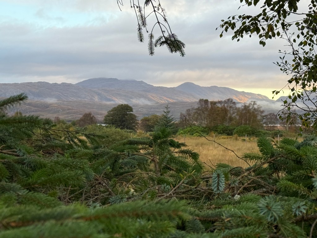
This was the Scotland I’d been imagining throughout those months of preparation.
Not simply magnificent scenery, but a landscape where geography had shaped centuries of human history. Mountains, sea lochs and narrow coastal approaches had influenced where people settled, traded, fought and constructed their strongholds.
And nowhere was that relationship more apparent than at my next photographic opportunity.
Castle Tioram – The Fortress Guarding Loch Moidart
I’d been particularly keen to catch sight of Castle Tioram, another remarkable medieval stronghold, standing on the tidal island of Eilean Tioram at the meeting of the River Shiel and Loch Moidart.
The location is extraordinary.
The castle occupies a rocky outcrop overlooking the waterways that once provided an important route between the sea and the settlements further inland. Its position allowed those controlling it to oversee movement through this strategically significant part of the western Highlands.
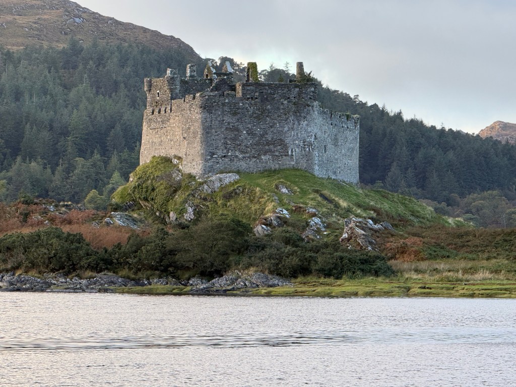
The surviving structure dates largely from the thirteenth century onwards and became one of the principal strongholds of the MacDonalds of Clanranald.
This was territory steeped in clan politics, shifting alliances and the recurring struggle for influence over the western Highlands and Islands.
Castle Tioram played a central role in that story for centuries, serving as a residence and administrative centre for the Clanranald chiefs. Its eventual abandonment is traditionally associated with the Jacobite rising of 1715, when Allan MacDonald of Clanranald is said to have set fire to the castle to prevent it falling into government hands.
The historical record confirms that the castle was burned in 1715, although, as with so many Highland stories, the circumstances have acquired a little additional colour through generations of retelling.
Today, its roofless walls and weathered stonework make it one of the most atmospheric ruins in the region. And there was another reason I found this particular castle so compelling. Beyond it lay Loch Moidart and Eilean Shona, the island that had been the real destination of this extraordinary journey from the beginning.
After months spent studying photographs, planning routes and imagining what lay ahead, I was finally approaching the place itself.
Although, before the island adventure could begin, there was still the small matter of finding somewhere to sleep.
Loch Shiel Hotel – Almost There
My destination for the evening was the Loch Shiel Hotel in Acharacle, a traditional Highland hotel close to the southern end of Loch Shiel. After a day that had begun in the pouring rain amongst prehistoric monuments, continued through Oban and its excellent seafood, and involved enough medieval castles to satisfy even the most enthusiastic student of Scottish history, I was more than ready to call it a day.
The hotel was perfectly situated for the next stage of the journey, and arriving in the fading evening light brought a welcome sense of having finally reached the western Highlands.
But the adventure was already beginning to take shape beyond the mainland.
The Advance Party – Kitchen in the Wild Gets Underway
One of the more exciting moments of the evening was catching sight of the advance party involved in preparing our forthcoming Kitchen in the Wild adventure.
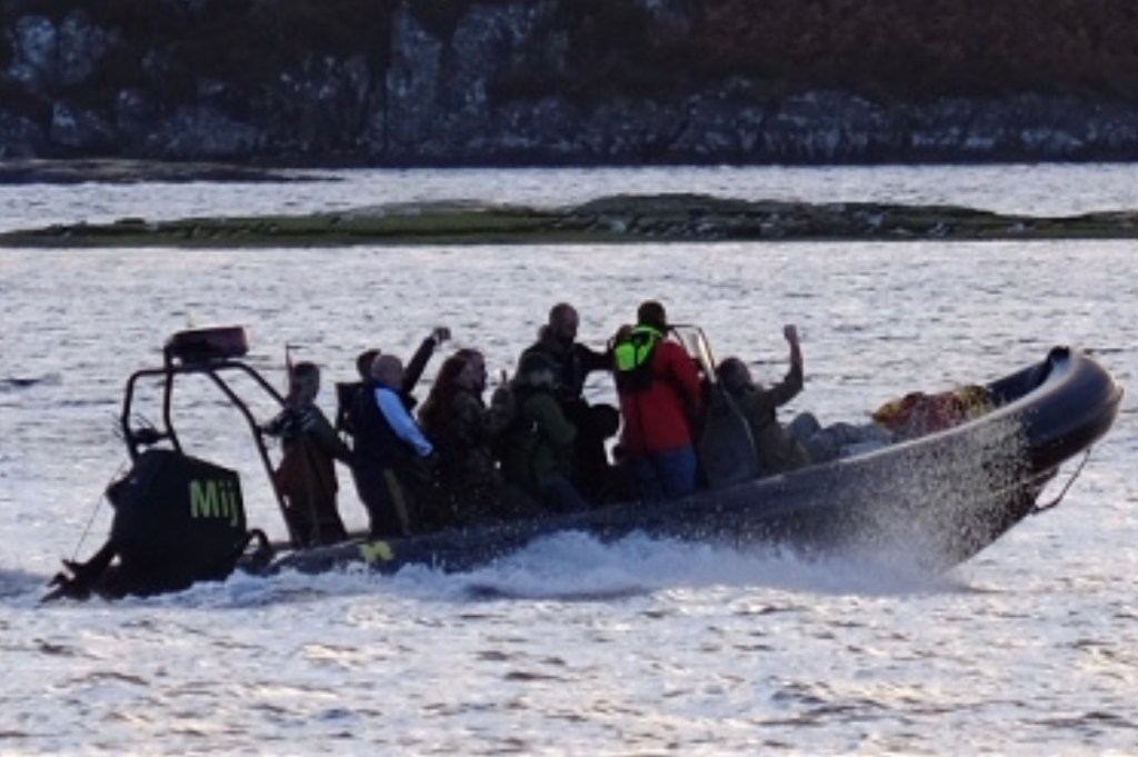
There they were, heading across the water, already engaged in the considerable business of getting everything ready for the main event, and what an event it promised to be.
Kitchen in the Wild had chosen Eilean Shona for its October 2026 Scottish adventure, bringing together a small group of food enthusiasts for several days of cooking, exploring and celebrating the extraordinary natural produce of Scotland’s west coast.
Joining host and chef Valentine Warner was special guest Nathan Outlaw, one of Britain’s most respected seafood chefs, whose two Michelin-starred restaurants in Port Isaac have established an exceptional reputation for allowing outstanding fish and shellfish to take centre stage.
The programme also included mixologist extraordinaire Nick Strangeway, co founder of the infamous St. John in London, Jon Spiteri and natural-history illustrator Anna Koska, alongside local guides and experts.
The prospect of exploring this remote island, surrounded by magnificent coastal scenery and an abundance of exceptional natural ingredients, had been occupying my thoughts ever since that original email landed in my inbox back in March 2025.
And now, seeing some of the team making their preparations, the whole thing suddenly felt very real indeed.
The anticipation was building.
Rather wonderfully, after travelling through thousands of years of Scottish history, I was now looking forward to something altogether more immediate.
What was for dinner?
And I suspected that, from this point onwards, things were going to become considerably more interesting.
The End of a Rather Extraordinary Wednesday
By the time I settled in at Loch Shiel Hotel for the evening, I had plenty to reflect upon.
I’d begun the day in Kilmartin, contemplating the lives and beliefs of people who had inhabited Scotland thousands of years before recorded history.
I’d crawled around beneath an ancient burial monument attempting to photograph prehistoric deer, wandered amongst enormous standing stones, explored a ceremonial landscape that had evolved over centuries and enjoyed an excellent seafood lunch overlooking Oban’s busy harbour.
Then came medieval strongholds, a ferry crossing, a village named after a chemical element and a magnificent drive through some of the finest scenery Scotland has to offer.
Not a bad day’s work.
And the weather, having started with what appeared to be a personal vendetta against my camera equipment, had eventually decided to cooperate. Kitchen in the Wild wasn’t due to begin until 4:30pm the following afternoon, which meant I still had the best part of Thursday to indulge my curiosity before joining everyone.
Naturally, I’d already planned how to fill it.
There was the small matter of a journey out to Ardnamurchan Lighthouse, perched at the most westerly point of mainland Britain, together with a few other places I’d earmarked during my research. After all, it would have been positively irresponsible to travel this far into the Highlands and not investigate a little further.
So, one more morning of exploration before exchanging the hire car and carefully printed itineraries for boats, island life, exceptional food and the company of a group of people who shared a common enthusiasm for all things edible. Nineteen months after that first email, the adventure I’d originally signed up for was almost upon me.
But first, there was a lighthouse to find.
And knowing Scotland, probably another opportunity to test the waterproofs.
…………………. Until Next Time ………….. L8ers …………….


brilliant Jules missed the chance of walking with you ________________________________